SiteSelection
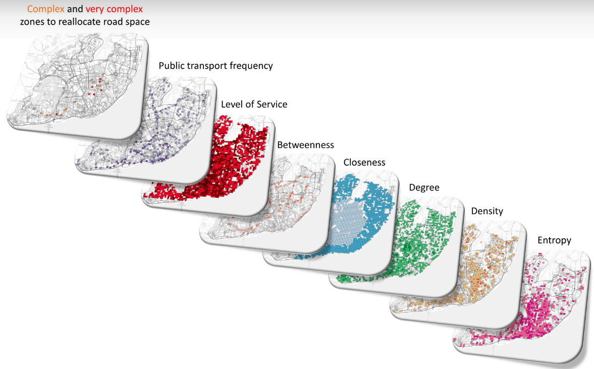
An open-source tool to identify complex areas for street space reallocation
Problem
Using point and click software to fetch and process data…
This is fine for a single case study 😀
But what it you want to replicate the exactly same process for 400 other locations? 🤯
Options
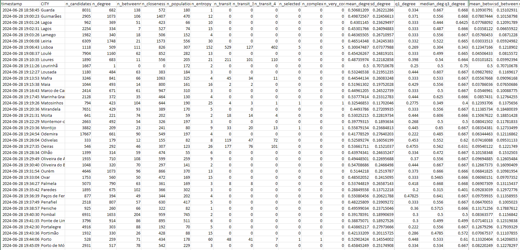
Thresholds for candidate selection
degree_min = mean           # mean or median? default: mean
betweeness_range = 0.40     # percentile to exclude (upper and lower) default: 0.25
closeness_range = 0.25      # percentile to exclude (upper and lower) default: 0.25
population_min = median     # mean or median? default: mean
entropy_min = 0.35          # value to exclude (lower) default: 0.5
freq_bus = c(4, 10, 20) # frequency of bus stops to define level of service 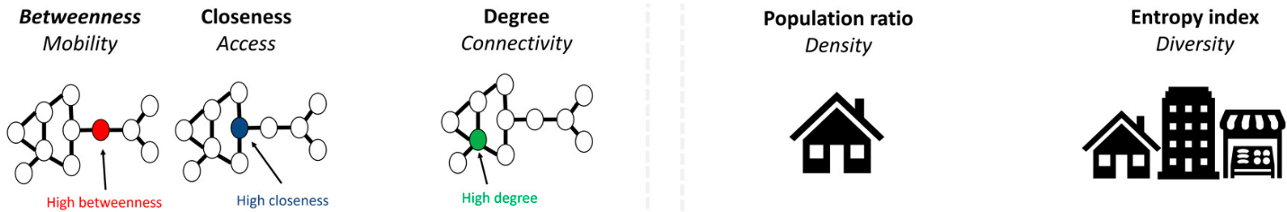
For different contexts, we can have different cut thresholds… Under assessment
Options
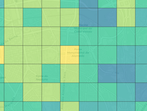
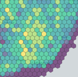
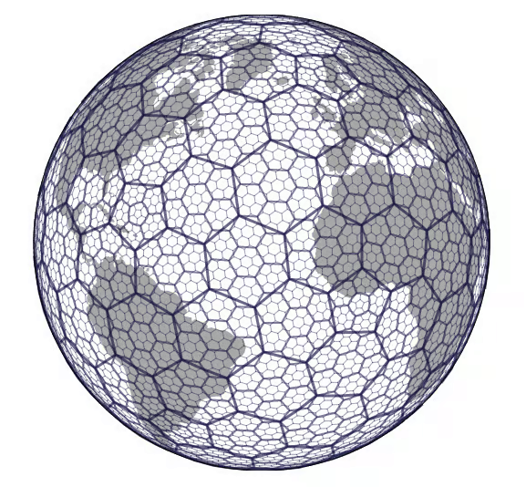
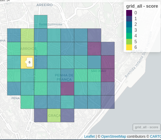
Grid types
- Squares
- Hexagons
- Universal h3 hexagon grid - useful to include other variables
Options
Work with non-administrative boundary
- Set another polygon limit to the analysis
- create a
.geojsonfile with the area of interest
Options
Keep track of your analysis and export results
Thank you
More: u-shift.github.io/SiteSelection

contributions are welcome!
Rosa Félix - rosamfelix@tecnico.pt
About
This work is part of Streets4All Project, developed at the University of Lisbon and at the University of Coimbra, and funded by Fundação para a Ciência e Tecnologia (PTDC/ECI-TRA/3120/2021).

This work is part of the research activity carried out at Civil Engineering Research and Innovation for Sustainability (CERIS) and has been funded by Fundação para a Ciência e a Tecnologia (FCT), Portugal in the framework of project UIDB/04625/2020, project PTDC/ECI-TRA/3120/2021, and project 2022,07909,CEECIND/CP1713/CT0017.
The concept is based on:

Valença, Gabriel, Filipe Moura, and Ana Morais de Sá. 2024. “Where Is It Complex to Reallocate Road Space?” Environment and Planning B: Urban Analytics and City Science 51 (6): 1290–1307. https://doi.org/10.1177/23998083231217770.